Drone surveying falls into into several categories. We specialise in 3 aerial surveying services at Matthew Jones Photography. Data sets allow for integration with QGIS and AutoCAD.
- High quality 2D orthomosaic maps
- 3D Orthomosaic maps
- Aerial inspections
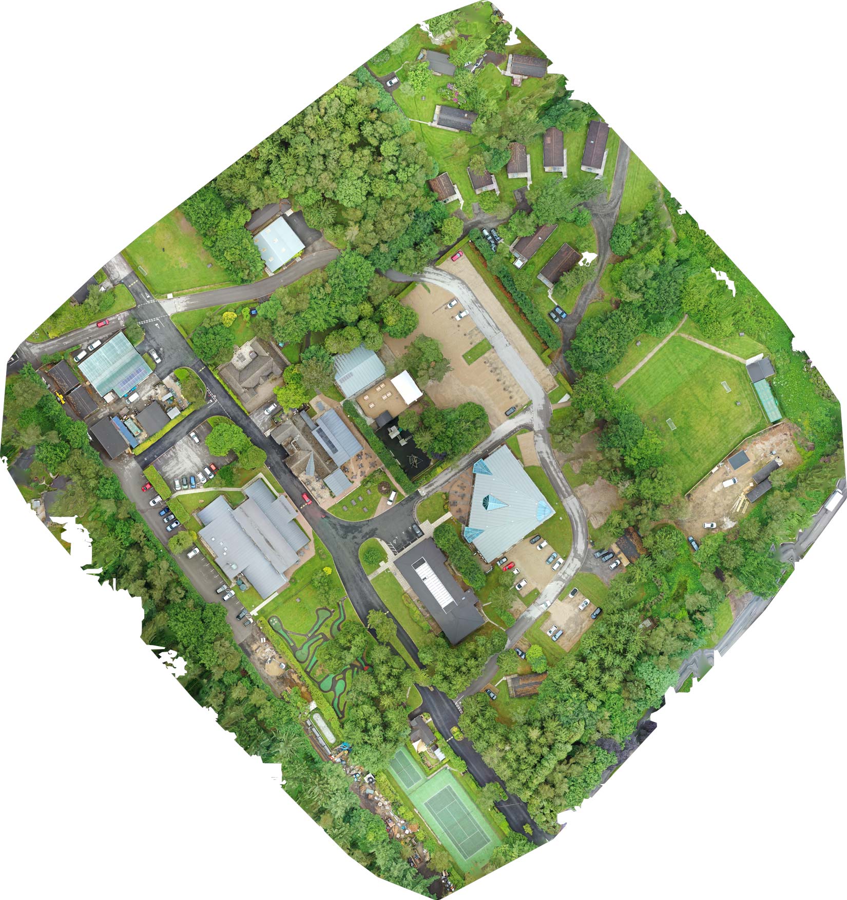
2D Orthomosaic Maps
An orthomosaic map is a detailed and accurate photographic representation of an area that has been geometrically corrected.
Using specialist software we stitch together hundreds of images to produce high quality 2D Orthomosaic maps. An orthomosaic map is created by capturing photos from a drone with an overlap and stitching them together. The stitched image is geometrically corrected (orthorectification) to remove perspective and provides a uniform scale allowing for accurate measurements of distance and area. GSD is 1.98 cm/p
Orthomosaic maps also called orthophotos are simer to Google Maps. However they are more accurate and detailed and at a much higher resolution allowing you to zoom in to a much greater extent and pick up details not present on Google. For increased accuracy we can add Ground Control Points (GCP)
A big advantage is you know exactly when the map was created and can track changes and progress over time.
If you have any questions about drone surveying please get in touch.
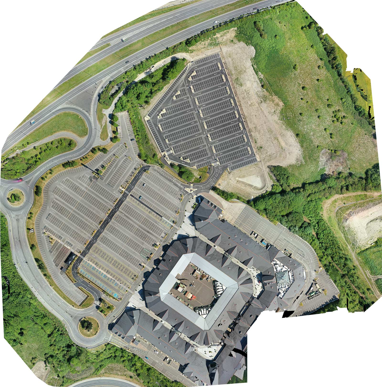
Drone Surveying services have many uses such as the construction industry example above or the holiday park sector with example below.
3D Orthomosaic Maps
3D orthomosaic map provide useful information for the construction, forestry and surveying industries. We provide the files and images for integration with QGIS and AutoCAD.
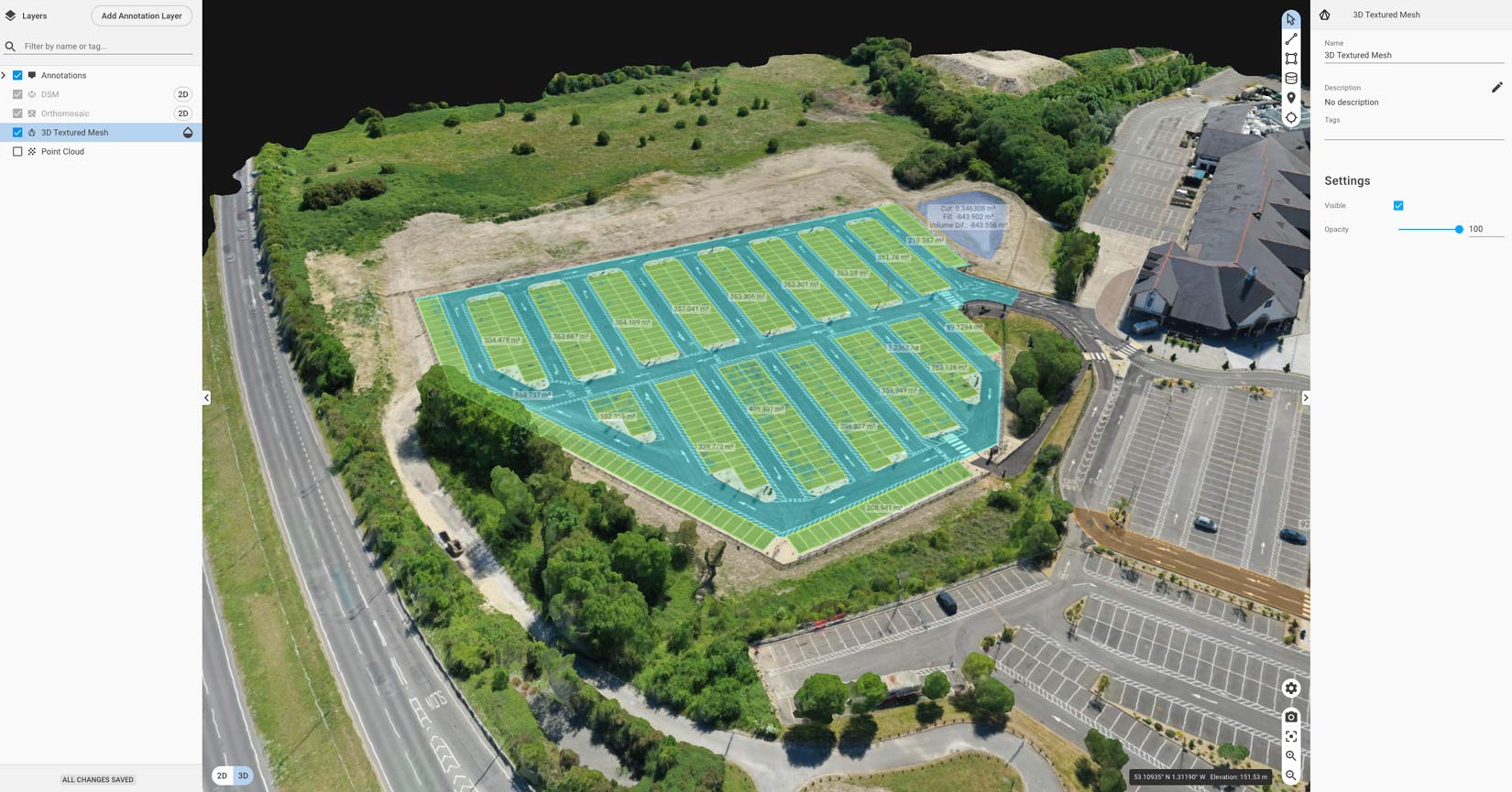
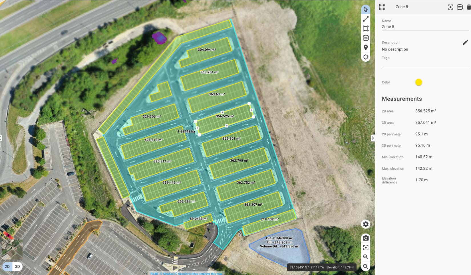
Orthomosaic maps allow quick measurement of length, area, and volume.
We also provide Drone Inspection and Drone Filming in attention to to our Drone Surveying services