How do to celebrate the 50th anniversary of your organisation? Kirk Hallam Community Academy located just outside Ilkeston decide to involve the entire school. Around 500 pupils and staff took park in this PR Shoot.
Matthew Jones is a qualified drone pilot and set up the shot my marking out the gigantic 50 on the school playing field. This was a great way to involve the entire school.

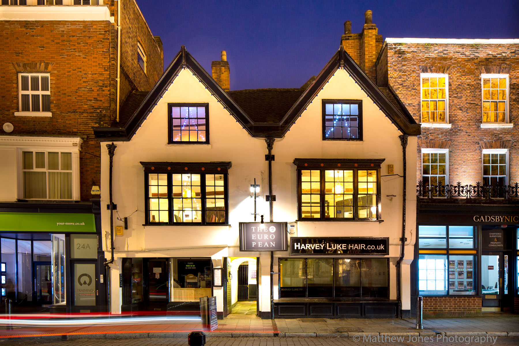
We provide a full range of commercial photography services and enjoy a challenge.
What is PR Photography
Professional PR photography is about having really good photography to go with a great story. If you have a story then you need an eye catching image to go with it. Whatever your story, a business launch, new store or a special business anniversary it will get more attention with a professionally shot photograph.
Not only do we produce high quality and compelling imagery, we can advice you on what to do and provide creative input.
PR photography can be used on your social channels, your emails, your website and given to the media whenever you share a story. Editors love a strong photograph and you are likely to receive better coverage with a photograph shot by Matthew Jones Photography
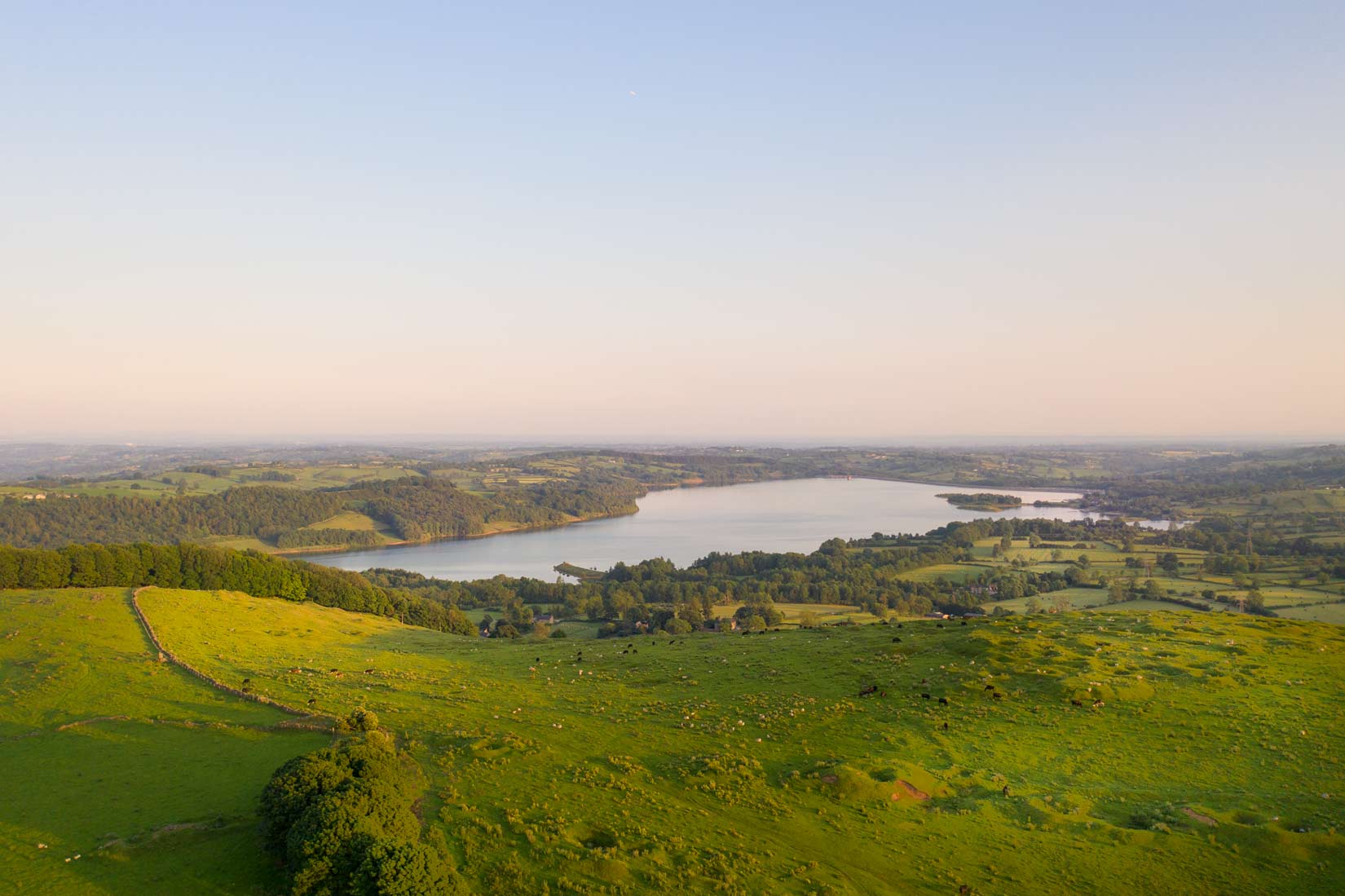
Drone surveying falls into into several categories. We specialise in 3 aerial surveying services at Matthew Jones Photography. Data sets allow for integration with QGIS and AutoCAD.
- High quality 2D orthomosaic maps
- 3D Orthomosaic maps
- Aerial inspections
2D Orthomosaic Maps
An orthomosaic map is a detailed and accurate photographic representation of an area that has been geometrically corrected.
Using specialist software we stitch together hundreds of images to produce high quality 2D Orthomosaic maps. An orthomosaic map is created by capturing photos from a drone with an overlap and stitching them together. The stitched image is geometrically corrected (orthorectification) to remove perspective and provides a uniform scale allowing for accurate measurements of distance and area. GSD is 1.98 cm/p
Orthomosaic maps also called orthophotos are simer to Google Maps. However they are more accurate and detailed and at a much higher resolution allowing you to zoom in to a much greater extent and pick up details not present on Google. For increased accuracy we can add Ground Control Points (GCP)
A big advantage is you know exactly when the map was created and can track changes and progress over time.
If you have any questions about drone surveying please get in touch.
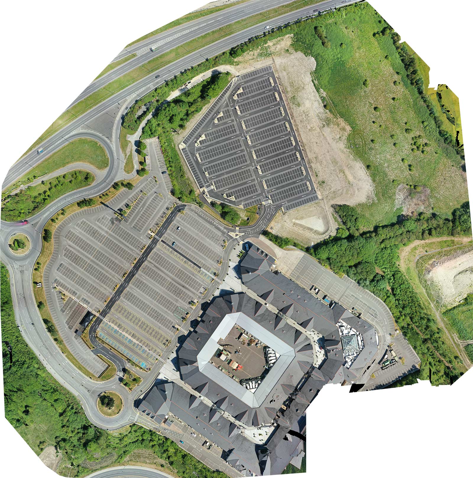
Drone Surveying services have many uses such as the construction industry example above or the holiday park sector with example below.
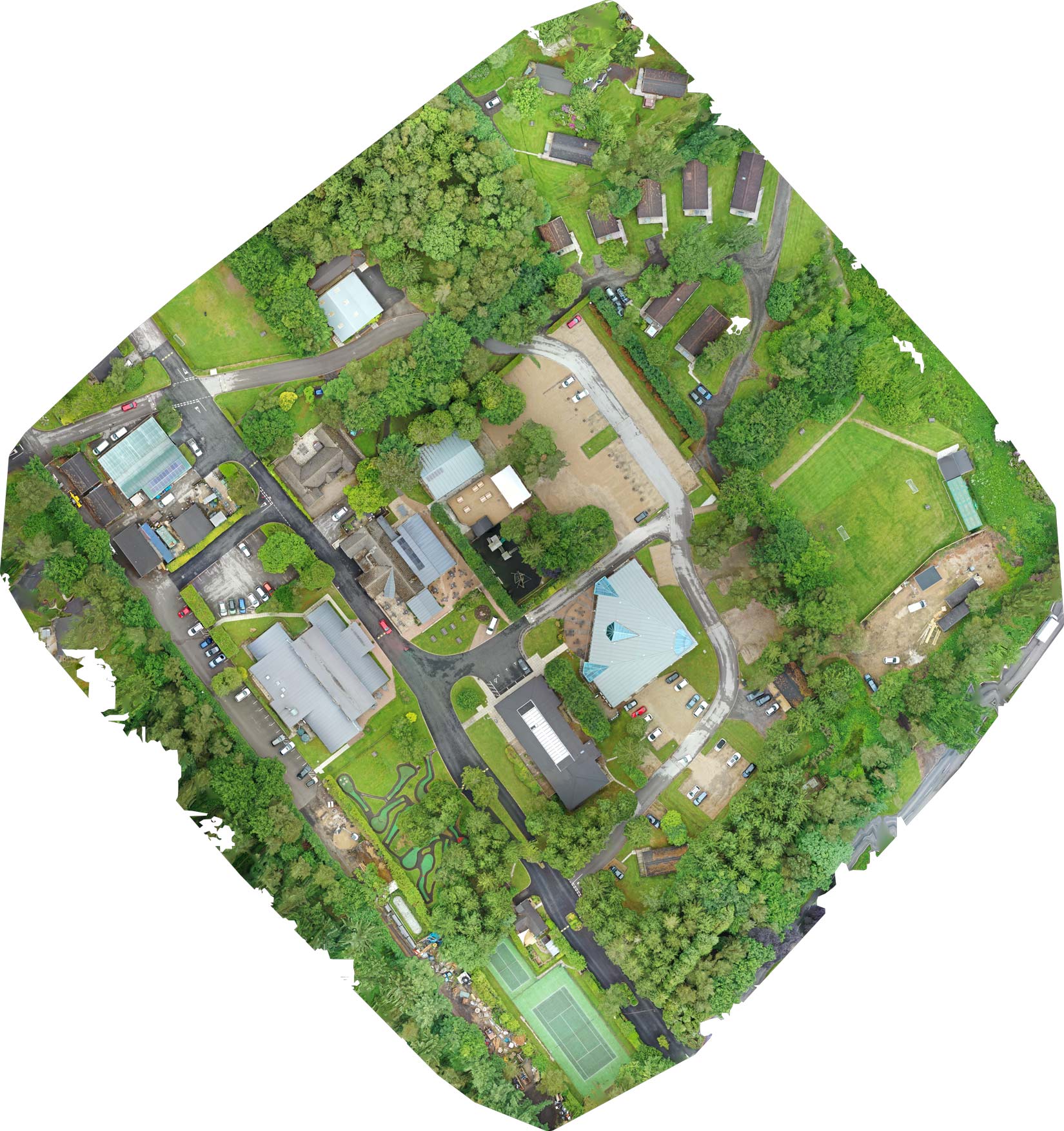
3D Orthomosaic Maps
3D orthomosaic map provide useful information for the construction, forestry and surveying industries. We provide the files and images for integration with QGIS and AutoCAD.
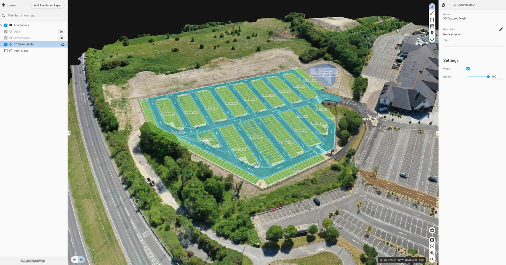
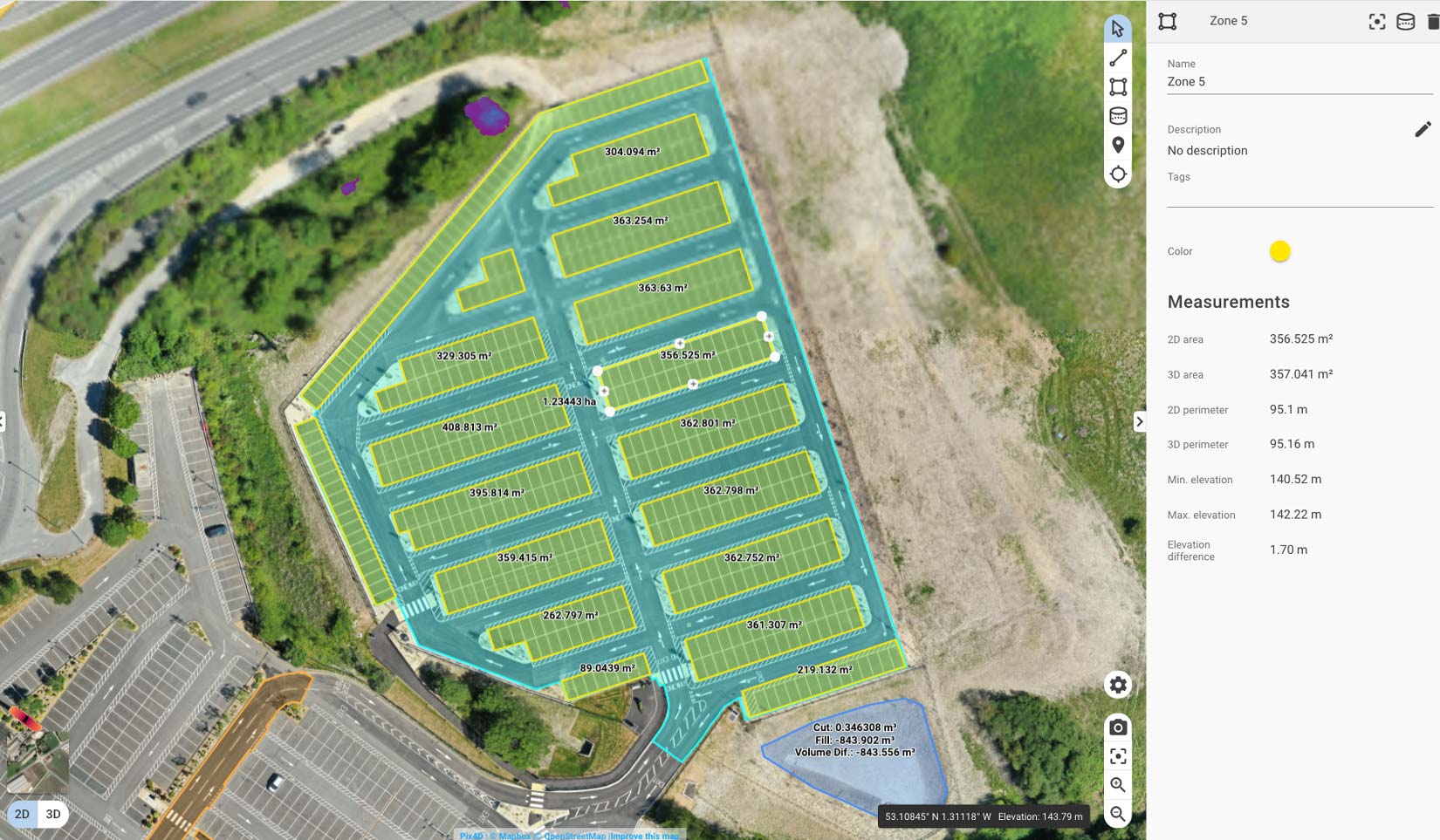
Orthomosaic maps allow quick measurement of length, area, and volume.
We also provide Drone Inspection and Drone Filming in attention to to our Drone Surveying services
Drone filming is a great way to explore a destination. Here is a short video we produced for Darwin Forest and also a spectacular 360 aerial photography.
Our aerial footage in shot in 4k high resolution and it is recommended to view in full screen mode for the best experience.
Darwin forest is beautiful in every season.
These 360 photographs show the glorious Derbyshire countryside.
Our drone pricing includes grading, editing, music and your logo. There are no hidden costs or extras. The price quoted is for the end product.
Prices also include a remote pre site survey, site risk assessments and insurance.
This is a guide to our costs and all jobs are different, but this is the bases for your quote. An edited ready to go film of 1 to 3 minutes will cover most requirements Information about Drone Filming and Photography can be found here
What do I need to know to hire or commission a drone service provider?
Drone footage costs
We charge £595 for a fully edited aerial video.
Price is important but there are other considerations you should be aware of.
Quality Matters
We shoot in 4k to ensure high quality footage that copes well with high dynamic range scenes and we know how to get the best shots, pans and angles.
Once the footage has been captured we produce the first draft, you have the chance to make changes then. Within the price quoted we will add your logo and graphics. We have a selection of royalty free music or can also add a sound track of your choice, just be aware there maybe be a license fee
Once the final version has been completed we send you the 4k version via a download link and an additional 2k version if required.
Aerial filming and 360 tours
Aerial tours have a wow factor and are a really good way of showing a location. You can get more information on Virtual Tours here Your photosphers / nodes will be uploaded to Google maps and your places page.
You will also receive the pictures and embed code to add them to your website and distribute through your social media channels.
| Service Description | Additional Notes | Total Time | Cost | Add-ons |
|---|---|---|---|---|
| Edited 1 to 3 min branded film | Up 60 min air time | Upto 4 hrs | £595 | included. |
| 360 aerial tour | Upto 5 nodes. Added to Google | Upto 2 hrs | £250 | £30 per additional node |
| 360 aerial tour & Google tour | Upto 5 / 25 nodes | Upton 4 hrs | £425 | |
| Navigational overlay | Branded with hotspots. | n/a | £125 | £20 per year hosting |
| Drone Inspection | Up 80 min air time | Upto 3 hours | £125 - £375 |
If you are looking for our Commercial Photography rates you can find them here.
Previous Drone filming Projects
You now have a good idea of the cost and below are films we have produced covering a range of sectors.
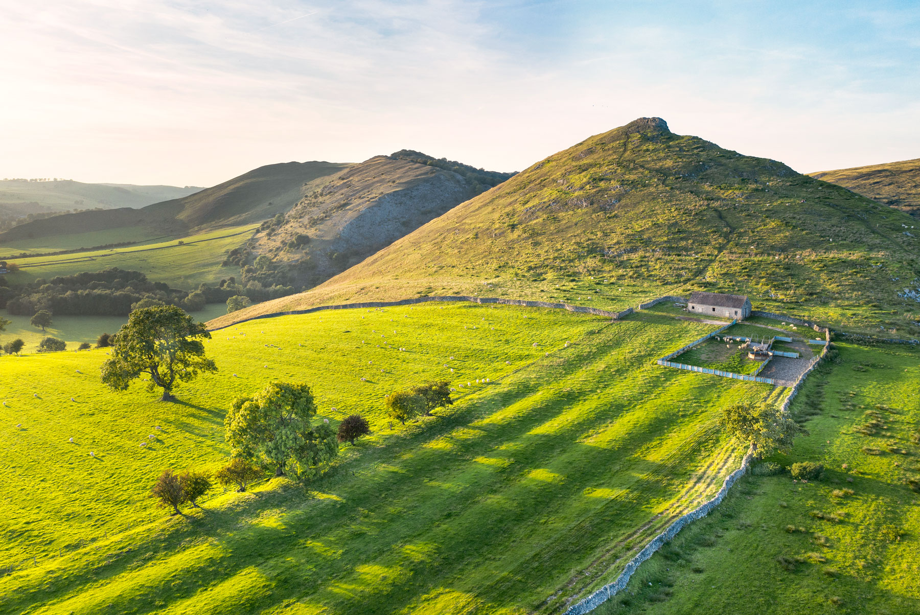
The stunning Derbyshire landscape is full of history. I'm working on a project to film and photographing Derbyshire landmarks using a high resolution 4k drone.
The project is about showing their inherently beautiful from the air and revealing a fascinating history.
A land Shaped by Human History
The history of Derbyshire stretches back into the mists of time. To the occupiers of the Iron Age hill forts the barrows and stone circles were already ancient history.
From the ancient lead mines and more modern limestone quarries in the west, to the mills along the Derwent and Amber valleys, the coal fields in the west and the gritstone moors to the North. The geographic features of Derbyshire have been key to determining the industries past and present that are found it Derbyshire.
Religion too has been an ever present feature of the Derbyshire landscape. Minninglow and the many church spires, stone circles and granges testify to this.
The industrial revolution caused significant changes and upheaval to the people and landscape of Derbyshire. Many of the historic houses and old railways, canals, reservoirs and even the iconic limestone walls are a
All testify to man's presence and to the imperatives of histories of that particular era.
Even what we perceive as natural beauty is shaped by man, the moors of the Dark peak have been carefully managed for centuries and the limestone walls and farmlands of the white peak are grazed by sheep and cattle.
Thousands of years of human presence, remains and is reflected back to us in the Derbyshire landscape, testifying to the times they lived it in and the impact of the wider world on this corner of the world.
You cannot truly experience Derbyshire without feeling this presence and at the same time being part of it.
About the Project
The COVID pandemic has reduced our workload significantly since March.
We remained positive though and have not been idle, launching a new website and adding additional drone based services. I also began a project to raise awareness and promote my home county of Derbyshire, with the desire to keep the positivity flowing and be a small part of the county and countries #businessbounceback
Ashover Rock
Capture the scale and features of a location unachievable by ground based view points.
4k drone footage combined with high resolution 360 degree photography and a media rich virtual tour is a wonderful way to show and tell a story.
Our high production values and creative approached paired to a supportive and helpful client service ensure you get the best package possible. From the start to completion and beyond we are there to advice and go the extra mile.
Exciting | Compelling | Informative
#BusinessBounceBack Package details
- 3 site visits for data capture
- flight restrictions may apply
- Photography
- Still Photography up to 30 photographs
- Any combination of styles
- Fully edited film, (up to 3 mins duration), including
- Soundtrack
- Info Graphics
- Voice over (additional cost if we produce it)
- Logos and Branding
- Titles
- 4k (additional lower resolution available at no extra charge)
- Virtual Tour
- Branded navigational overlay / menu
- 30 x 360° photospheres
- Aerial 360 photography, up to 5 x 360° photospheres
- Information hotspots
- Text, audio and visual integration
- GPX downloads for walking and cycling routes (we can create this for you)
- Free QR code generation
- Branding
- HTML 5 compatible
- Google integration included for free.
- Embed code
- 1 year of monthly statistical reporting
- 3 years free hosting. (£17 per year after )
Package Cost £1250
For more information about Virtual Tours on our dedicated page. Please look at our Drone Filming section to discover more about our drone services.
Matthew Jones Photography also provides a Drone Inspection service and Place Marketing Photography
We are small friendly team who that takes pride in what we do, pairing creativity and the latest technology with good old fashioned customer service.
Be Noticed | Gain Trust
Aerial footage and imagery shot by Matthew Jones with our 4K drone has the wow factor. We are creative filmmakers with high production values paired with great customer service.
Our Drone Package - Show Don't Tell
Package details
- 3 site visits
- A fully edited film for each visit
- Aerial photographs from each visit included
- Edited film combining all visits on project completion
- Branding, titles and soundtrack included
- 4 films in total
- 4k footage (lower versions resolution available at no extra charge)
- Cost £1200 (saving £150)
Capture the scale and features of a location unachievable by ground based view points.
We charge £450 for a standard film including all editing, grading, graphics and branding. This is already a good price.
- Orthormosaic maps from £175
- 3D models from £175
- Additional visits £375
- Voice-overs and site / PR interviews
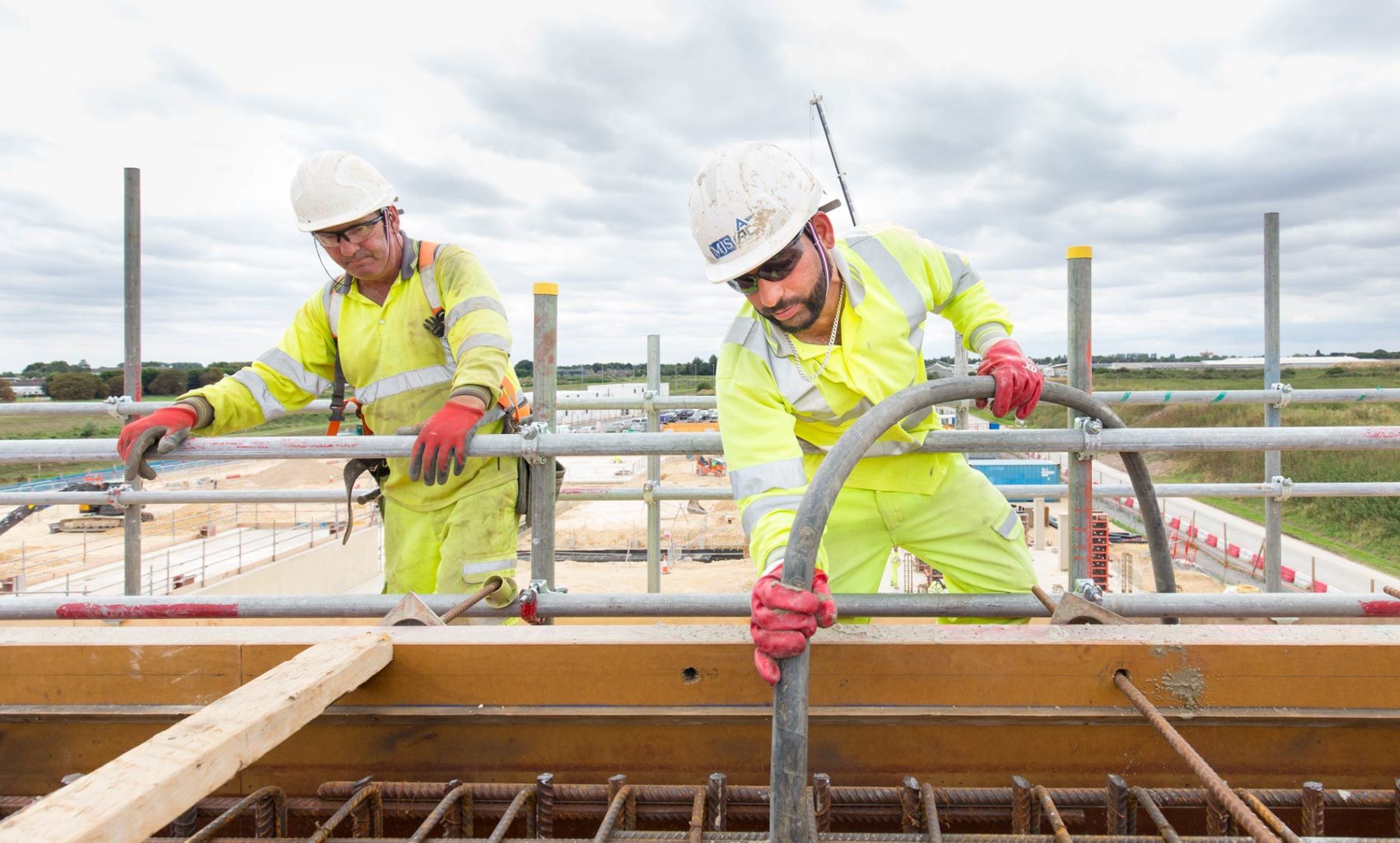
- Construction Photography
- Headshots and portraits
Drone Imagery | A Versatile asset
The marketing material we send clients has many uses
- Social media posts
- LinkedIn articles
- Client updates
- Prospective client proposals and presentations
- Website case studies
- Trade shows and events
- Site planning
- Site inductions
- Healthy and Safety and emergency procedures
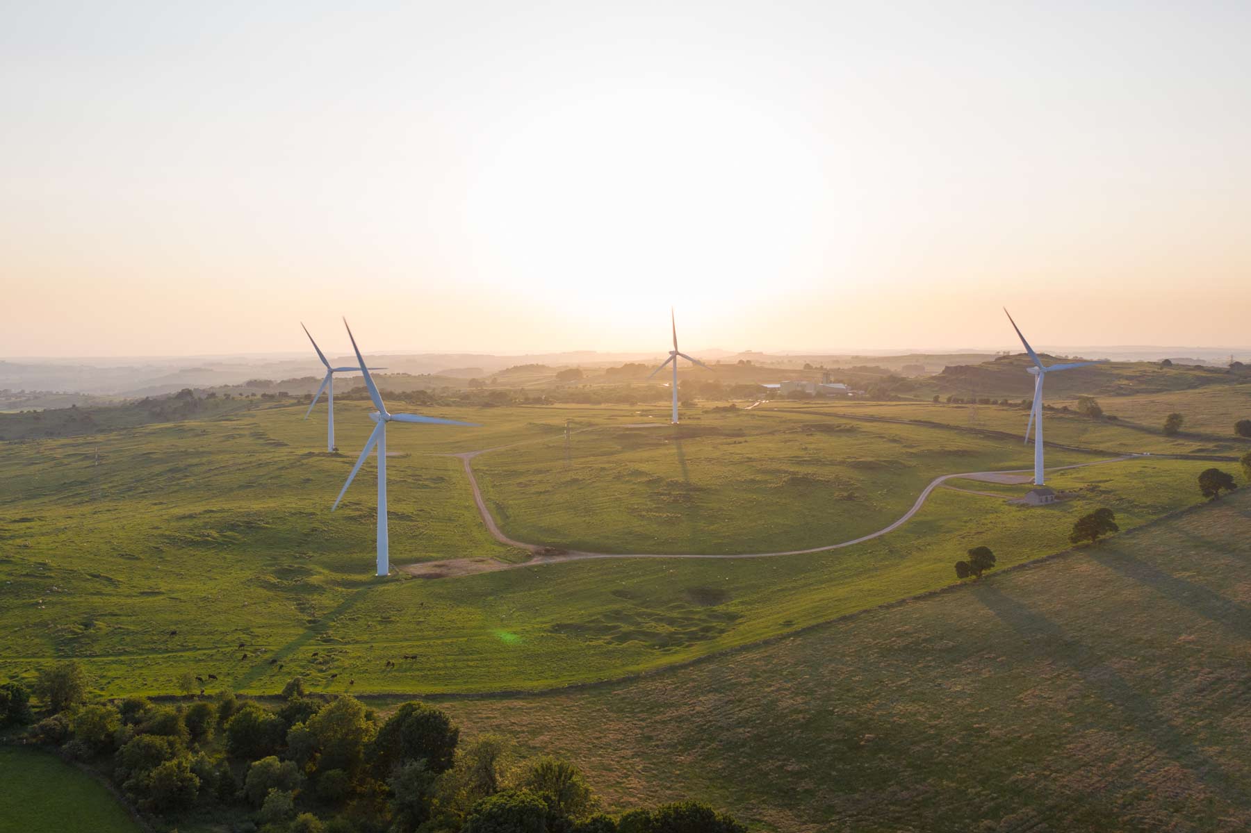
The impressive Bennereley Viaduct is located in the coalfields on the eastern borders of Derbyshire. It sits in a very different landscape to the Wind turbines at Carsington Pastures. Much like them it exists because of the industrial imperatives of the era they were created and has become an integral to the Derbyshire landscape
These two films were shot using a high resolution 4k drone and are best viewed in full screen.
Bennerley Viaduct is a disused railway viaduct spanning the Erewash Valley between Awsworth (Nottinghamshire) and Ilkeston (Derbyshire) in central England.
This wrought iron lattice work viaduct is 1452 feet long with the rails 60 feet 10 inches above the Erewash River. Most railway viaducts at the time were brick-built but the foundations of the Bennerley Viaduct were subject to a great deal of coal mining subsidence therefore, the lighter wrought iron design was chosen.
The viaduct was built between May 1876 and November 1877 and formed part of the Great Northern Railway Derbyshire Extension which was built in part to exploit the coalfields in Derbyshire and Nottinghamshire.
Bennerley viaduct's wrought iron construction saved it from demolition. The demolition contractors who tendered for the contract to demolish the viaduct put forward amounts that were considered too high. The reason given for the high cost was that wrought iron structures could not be cut up with an oxy-acetylene torch and would have to be taken apart rivet by rivet.
The viaduct survived to become a grade II* listed structure. It is on the Buildings at Risk Register.
One of Derbyshire's icon and most recognisable landmarks Riber Castle sits some 853 feet above sea level, high above the Derwent Valley overlooking the town Matlock.
This aerial film was shot by Matthew Jones using a Mavic drone in 4k, it is best viewed in full screen
The mock gothic castle forms a dramatic silhouette comprising 90 feet high towers and over 145 feet of battlement walls. Building began 1862 as both a family home and a symbol of his success by John Smedley, the Victorian mill owner.
Riber Castle was one of several Derbyshire locations used during filming of Dead Man's Shoes. A film by Shane Meadows featuring Paddy Considine.
This short aerial film is ons of a series of films featuring Derbyshire iconic landmarks.
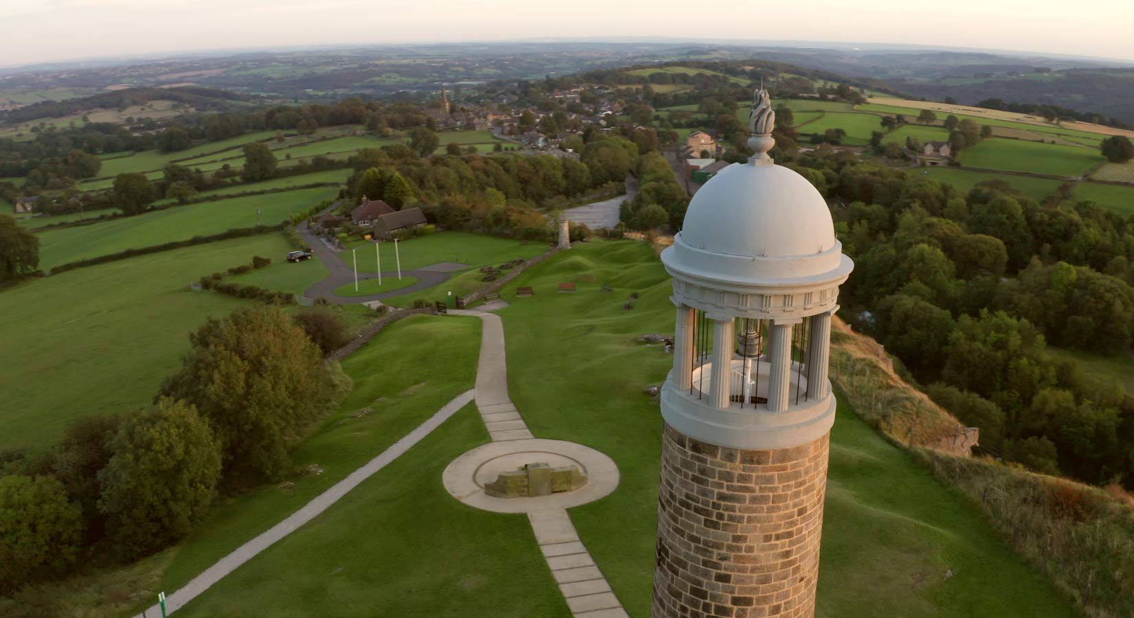
Crich stand can be seen in the background while not quite visible are the Senvion Wind Turbines near Harborough rocks further to the west in lead mining country of the White Peak
Click the Drone Film and Photography link to find out costs for a similar film.